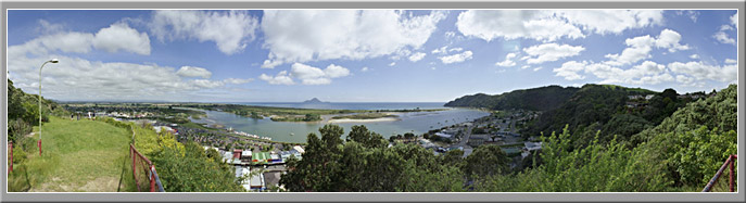
Click "view panorama" to see a wide shot of Whakatane and the surrounding landscape.
In this final section of the virtual field trip we focus on people and how they act during a natural disaster. To do this, you will be taking part in a role-play exercise during the lab class in the final week of semester. The exercise will be based around a realistic natural disaster in Whakatane and will be structured so that key parts of the community are represented.
Starting in week 11 of semester, you will receive email announcements about the build-up to the disaster. Make sure you check your University email regularly at this time.
Prior to the role-play exercise, you will be organised into one of the following teams to represent the Whakatane community:
Assessment for this lab exercise requires your participation in the role-play exercise. Provided you turn up and participate, you will earn 5%.
In order for the role-play to work, you need to do some preparation. To assist with this we have provided a range of resources. Click on the "resources" tab at the top of the page to see them. Please look through these and read the documents. They will help you know what to do in the disaster scenario.
The Google Earth placemark shows you the location of Whakatane in relation to the Bay of Plenty. You'll need to have Google Earth software installed on your computer to view it. Click here to download the software.